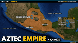
Map of the Aztec Empire and Aztec Triple Alliance
This map of the Aztec Empire and Aztec Triple Alliance was created by History Crunch to help students and teachers understand the geographic extent of the Aztec Empire at its height and the role of the Triple Alliance in its expansion across central Mexico. Designed for students in grades 5 to 12.