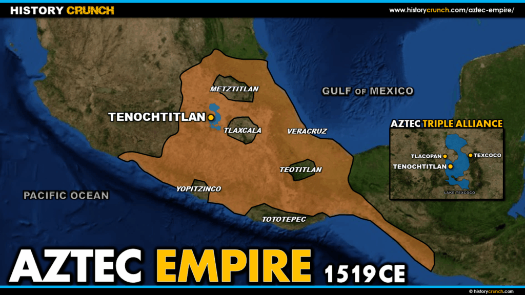
The Aztec Empire was one of the most powerful and extensive civilizations in the history of the Americas. At its height in the early 16th century, the empire stretched across most of central Mexico from the Gulf of Mexico to the Pacific Ocean, centered on the magnificent island capital of Tenochtitlan in the Valley of Mexico. The empire’s expansion was made possible in large part by the Aztec Triple Alliance, formed in 1428 between the Aztec, Texcoco and Tlacopan. This map was created by History Crunch to help students visualize the geographic extent of the Aztec Empire and the Triple Alliance, and is based on the History Crunch article titled Aztec Empire Overview.
Map of the Aztec Empire and Aztec Triple Alliance
About This Map
This map of the Aztec Empire and Aztec Triple Alliance was created by the History Crunch team to help students and teachers understand the geographic extent of one of the most significant civilizations in the history of the Americas. It is designed as a visual learning tool to accompany our full article on the Aztec Empire. Teachers may use it as a classroom display, a geography activity, or a discussion starter about the rise and fall of the Aztec Empire.
What This Map Shows
The map shows the geographic extent of the Aztec Empire at its height in the early 16th century, just before the arrival of Spanish conquistadors in 1519. The empire covered most of central Mexico and included territory stretching from the coastlines of the Gulf of Mexico in the east to the Pacific Ocean in the west. This vast territorial expansion was achieved through a combination of military conquest, strategic alliances and a sophisticated tribute system that forced conquered peoples to supply Tenochtitlan with goods, labor and warriors.
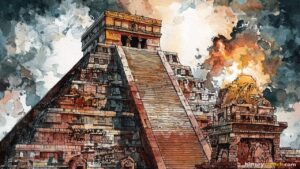
At the center of the map is the Valley of Mexico and the island city of Tenochtitlan, the capital of the Aztec Empire. By the early 16th century Tenochtitlan had grown into one of the largest cities in the world, with a population estimated at between 200,000 and 300,000 people, larger than any city in Europe at the time. The city was situated on an island in Lake Texcoco and was connected to the mainland by a series of causeways. At its center stood the Templo Mayor, the main pyramid temple of the Aztec.
The map also highlights the three city-states of the Aztec Triple Alliance: Tenochtitlan, Texcoco and Tlacopan. The Triple Alliance was formed in 1428 under the leadership of the Aztec ruler Itzcoatl, who united these three powers against their common rivals the Tepanec. Together the Triple Alliance overthrew the Tepanec and established dominance over the Valley of Mexico. Over the following decades the alliance continued to expand, conquering and incorporating many other Mesoamerican societies throughout central Mexico. The Aztec gradually became the dominant partner within the alliance and Tenochtitlan became the undisputed center of power in the region.
The map also shows the broader geographic context of the empire, including the territories of rival and allied groups such as the Tlaxcala to the east of Tenochtitlan. The Tlaxcala were a powerful independent city-state that resisted Aztec domination and maintained their independence throughout the period of Aztec expansion. This would prove significant when Spanish conquistador Hernan Cortes arrived in 1519 and formed an alliance with the Tlaxcala against the Aztec, a partnership that played a critical role in the eventual Spanish conquest of Tenochtitlan in 1521.
How to Use This Map in the Classroom
This map works well as a visual introduction to the Aztec Empire before students read the full overview article. It can be used as a geography activity asking students to identify the location of Tenochtitlan, the territories of the Triple Alliance and the extent of Aztec expansion across central Mexico. Teachers may also use it as a discussion prompt asking students to consider how geography shaped the growth of the Aztec Empire or why the location of Tenochtitlan on an island in the middle of a lake made it such a powerful and defensible capital. It pairs particularly well with the article on the Spanish Conquest of the Aztec Empire to help students understand the geographic dimensions of the conflict.
Related Articles
To learn more about the topics covered in this map, visit the following History Crunch articles: