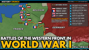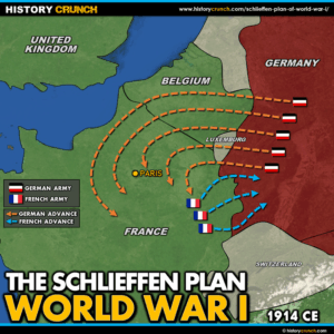
World War I Schlieffen Plan Map
This World War I Schlieffen Plan map was created by History Crunch to help students and teachers understand Germany’s pre-war military strategy for fighting a two-front war. It shows the planned German invasion route through Belgium and into France, why the plan failed and how its failure led directly to the development of the Western Front stalemate. Designed for students in grades 5 to 12.