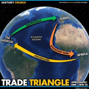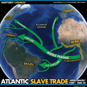
Atlantic Slave Trade Map
This Atlantic Slave Trade map was created by History Crunch to help students and teachers understand the geographic scope of the Atlantic Slave Trade from the 16th to the 19th century. It shows the regions of Africa from which enslaved people were taken, the routes across the Atlantic Ocean and the destinations across North America, South America and the Caribbean. Designed for students in grades 5 to 12.