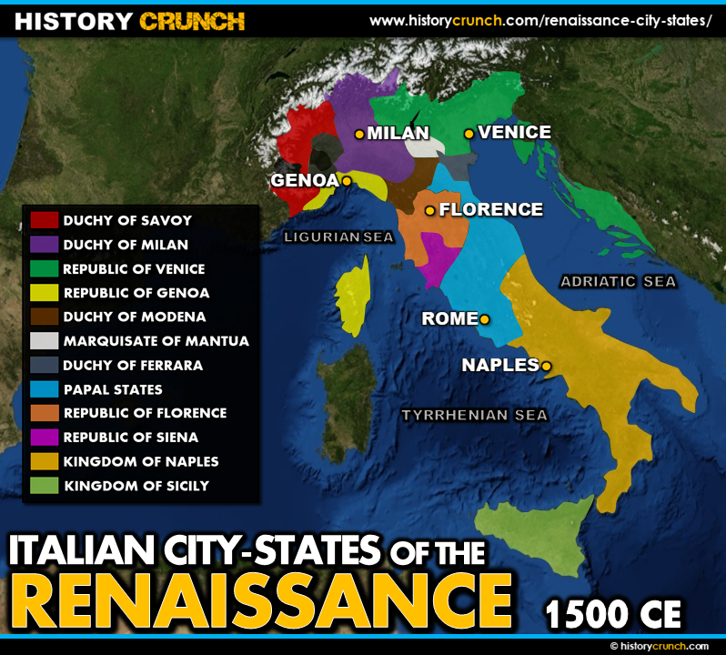
The Renaissance was one of the most important cultural and intellectual movements in European history, stretching from the 14th century to the 17th century. It began not in a single country but in the powerful city-states of the Italian Peninsula, where wealth from trade, strong banking industries and political independence created the ideal conditions for new ideas about art, science, philosophy and human potential to flourish. This map was created by History Crunch to help students visualize the geographic location of the major Renaissance city-states and is based on the History Crunch articles on the Renaissance.
Renaissance City-States Map
About This Map
This Renaissance city-states map was created by the History Crunch team to help students and teachers understand the geographic context of the Renaissance on the Italian Peninsula. It is designed as a visual learning tool to accompany our full articles on the Renaissance and its major city-states. Teachers may use it as a classroom display, a geography activity, or a discussion starter about why the Renaissance began in Italy rather than elsewhere in Europe.
What This Map Shows
The map shows the Italian Peninsula and the locations of the six major city-states that historians consider to be the birthplace of the Renaissance: Florence, Venice, Milan, Genoa, Rome and Naples. Each of these city-states developed independently with its own government, economy and cultural identity, and each made distinct contributions to the broader Renaissance movement.
Florence is widely considered the most important Renaissance city-state and is located in the northern section of the Italian Peninsula in the valley of the Arno River. It was the home of the powerful Medici banking family, whose enormous wealth and patronage of the arts made Florence the center of Renaissance culture in Europe. Artists such as Michelangelo and Leonardo da Vinci were closely associated with Florence. The Medici ruler Cosimo de Medici oversaw the construction of libraries, churches and academies and helped negotiate the Treaty of Lodi in 1454, which brought relative peace between the major Italian city-states.
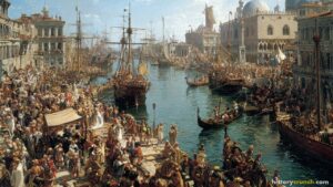
Venice is located on the northeastern coast of the Italian Peninsula in a shallow lagoon, built across 118 small islands connected by canals and bridges. Its extraordinary geographic position made it one of the most powerful trading centers in the medieval and Renaissance world. Venice developed a wealthy and influential merchant class, a powerful navy and a unique artistic tradition that blended Byzantine, Islamic and Renaissance influences. Artists such as Titian and Bellini worked in Venice, and the city became a major center for printing and publishing, helping spread Renaissance and humanist ideas across Europe.
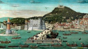
Milan was a powerful city-state in northern Italy known for its military strength and its patronage of the arts. Genoa was a major maritime and trading power on the western coast of the Italian Peninsula. Naples, located in the south, was one of the largest cities in Italy and an important political and cultural center during the Renaissance. Rome, as the seat of the Catholic Church and the Pope, held unique religious and political authority and became a center of Renaissance art and architecture, attracting artists including Michelangelo and Raphael to create some of the greatest works of the period.
How to Use This Map in the Classroom
This map works well as a visual introduction to the Renaissance before students read the full articles on individual city-states. It can be used as a geography activity asking students to locate each city-state on the Italian Peninsula and describe its geographic features. Teachers may also use it as a discussion prompt asking students to consider why Italy’s geography, particularly its coastline, river valleys and position at the center of Mediterranean trade, made it the ideal birthplace of the Renaissance. It pairs particularly well with individual city-state articles to help students compare the different contributions each city made to the broader Renaissance movement.
Related Articles
To learn more about the topics covered in this map, visit the following History Crunch articles: